mapsMaps ETC Site map
 Maps ETC > United States > Early America 1400-1800 > The Present Territory of the United States as claimed by European Powers, 1749
Site Map 

The Present Territory of the United States as claimed by European Powers, 1749

The Present Territory of the United States as claimed by European Powers


Title: The Present Territory of the United States as claimed by European Powers
Projection: Unknown,
Source Bounding Coordinates:
W: E: N: S:

Main Map Page
Zoomify Version
B/W PDF Version
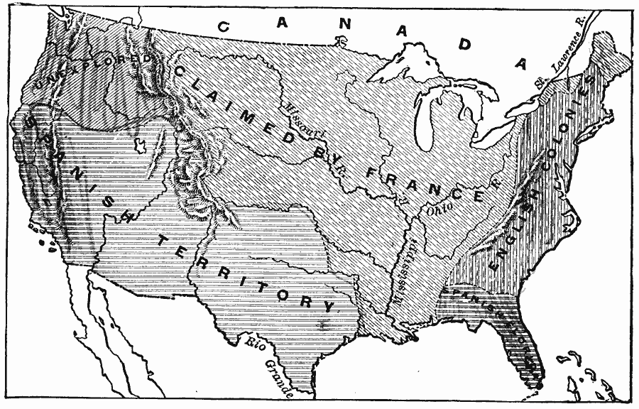
Description: A map of the present territory of the United States as claimed by the French, English, and Spanish in 1749.
Place Names: Early America 1400-1800, English, French, Spanish, Colonial Americ
ISO Topic Categories: oceans, location, inlandWaters
Keywords: The Present Territory of the United States as claimed by European Powers, borders, political, country borders, oceans, location, inlandWaters, Unknown, 1749
Source: Gertrude van Duyn Southworth, A First Book in American History (New York, NY: D. Appleton and Co. , 1907) 132
Map Credit: Courtesy the private collection of Roy Winkelman
SearchLicensePDF HelpGIS Help Google Earth Help Zoomify Help

 Maps ETC > United States > Early America 1400-1800 > The Present Territory of the United States as claimed by European Powers, 1749
Site Map