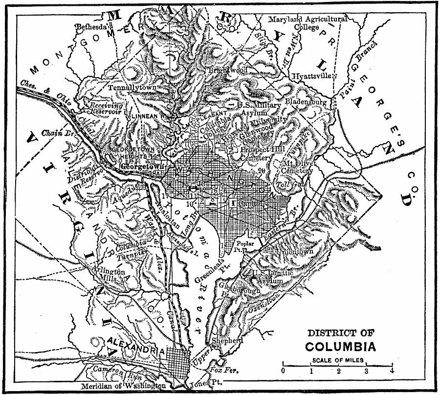
Description: A map from 1872 of the District of Columbia showing the Potomac River, Chesapeake and Ohio Canal, Washington and Alexandria Canal, the Long Bridge across the Potomac, the Capitol, Washington City, Georgetown, Alexandria and neighboring towns, railroads and turnpikes, and terrain features of the area.
Place Names: District of Columbia, Washington D.C., �Alexandria, �Georgetown,
ISO Topic Categories: boundaries,
inlandWaters,
location,
transportation
Keywords: District of Columbia, physical, �transportation, physical features, water routes, boundaries,
inlandWaters,
location,
transportation, Unknown, 1872
Source: James Monteith, Comprehensive Geography (New York, NY: A. S. Barnes and Company, 1872) 34
Map Credit: Courtesy the private collection of Roy Winkelman |
|