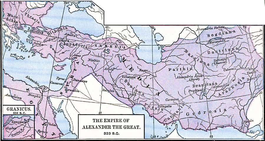
Description: A map showing the extent of the Empire of Alexander the Great in 323 BC, from Macedonia to northern Africa, across Asia Minor to the Indus River. The inset map show the site of the Battle of the Granicus in 334 BC, near Troy, where Alexander first defeated the Persians.
Place Names: Greece, Armenia, �Egypt, �Media, �Syria,
ISO Topic Categories: oceans,
location,
inlandWaters,
boundaries
Keywords: The Empire of Alexander the Great, borders, �political, kAlexandertheGreat, major political subdivisions, oceans,
location,
inlandWaters,
boundaries, Unknown, 323 BC
Source: Robert H. Labberton, New Historical Atlas and General History (New York, NY: Townsend MacCoun, 1886) Plate XI
Map Credit: Courtesy the private collection of Roy Winkelman |
|