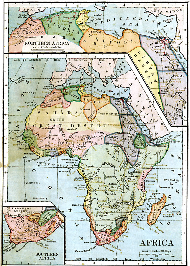
Description: A map of Africa showing the continent prior to the Berlin Conference of 1885, when the most powerful countries in Europe at the time convened to make their territorial claims on Africa and establish their colonial borders at the start of the New Imperialism period. While the majority of the continent is shown with vague territorial outlines for the native states, the areas of European interest along the Barbary Coast and Egypt, and the southern tip of the continent are detailed with inset maps. Major cities, ports, trade centers, and railroads are shown.
Place Names: A Complete Map of Africa, Algeria, �Egypt, �Madagascar, �Marocco, �Tripoli, �Negambia, �Cape colony, �Mozambique, �Zanguebar, �Abyssinia, �Nubia, �Fezzan,
ISO Topic Categories: boundaries,
inlandWaters,
location,
oceans
Keywords: Pre-Colonial Africa, physical, �political, kBerlinConference, physical features, country borders, boundaries,
inlandWaters,
location,
oceans, Unknown, 1883
Source: , Handy Atlas of the World (New York, New York: Ivison, Blakeman, Taylor and Co., 1883) 28
Map Credit: Courtesy the private collection of Roy Winkelman |
|