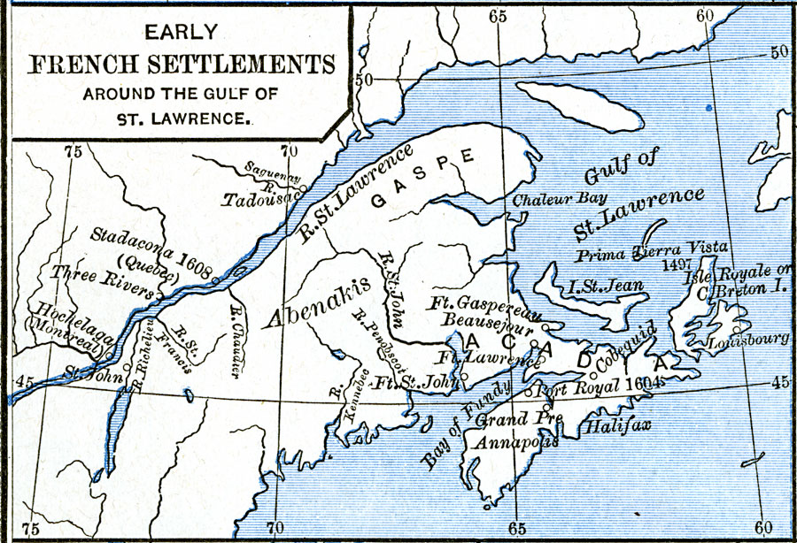
Description: A map showing the early French settlements around the Gulf of St. Lawrence and along the St. Lawrence River to Montreal. The map shows Prima Tierra Vista (Prima Terra Vista: First view of land) by John Cabot in 1497, Port Royal established in 1604, the Iroquois village of Stadacona near what was to become Quebec in 1608, the iroquois village of Hochelaga which became Montreal, St. John on the Richelieu River above Lake Champlain, Fort Gaspereau, Fort Beausejour, Fort St. John, Fort Lawrence, Annapolis, Halifax, Cobequid, and Louisburg. The map shows Cape Breton with the French name Isle Royal, and Prince Edward Island as Isle St. Jean.
Place Names: Canada, Cape Breton Island, �Halifax, �Montreal, �St. Lawrenc
ISO Topic Categories: oceans,
location,
inlandWaters
Keywords: Early French Settlements Around the Gulf of St. Lawrence, borders, �historical, historical event, oceans,
location,
inlandWaters, Unknown, 1497–1620
Source: Robert H. Labberton, New Historical Atlas and General History (New York, NY: Townsend MacCoun, 1886) Plate LVIII
Map Credit: Courtesy the private collection of Roy Winkelman |
|