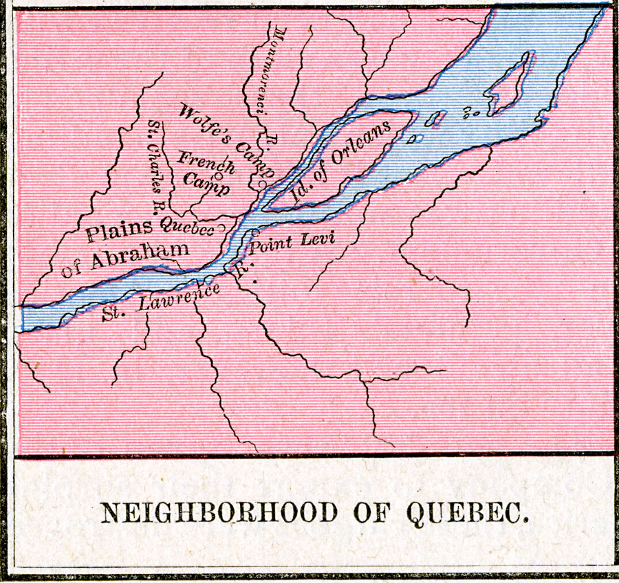
Description: A map of the area around Quebec showing important sites in the siege and capture of the city by the British General James Wolfe in 1759 during the French and Indian War (1754–1763). The map shows the location of Quebec, Wolfe's camp on the north bank of the St. Lawrence, Point Levi (Monckton's camp) on the south bank, the French Camp, and the Plains of Abraham, site of the battle leading to the capture of Quebec (12 September, 1759).
Place Names: Canada, Quebe
ISO Topic Categories: oceans,
location,
inlandWaters
Keywords: Neighborhood of Quebec, borders, oceans,
location,
inlandWaters, Unknown, 1759
Source: Robert H. Labberton, New Historical Atlas and General History (New York, NY: Townsend MacCoun, 1886) Plate LXIII
Map Credit: Courtesy the private collection of Roy Winkelman |
|