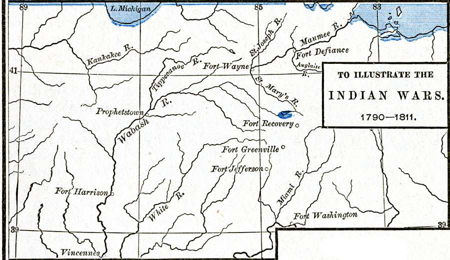
Description: A map of the area around the Wabash River showing the sites of the American Indian Wars between 1790 and 1811, including the Northwest Indian War (1785–1794) and Tecumseh's War (1810–1811). The map shows the forts and rivers of the area, including the Maumee River, site of the Battle of Fallen Timbers near present day Toledo (August 20, 1794), and Tippecanoe River, site of the Battle of Tippecanoe near Prophetstown (November 7, 1811).
Place Names: Early America 1400-1800, Defiance, �Greenville, �Harrison, �Prophetstown, �Recovery, �Vincennes, �Washington, �Wayne, �Native American
ISO Topic Categories: oceans,
location,
inlandWaters
Keywords: The Northwest Indian Wars, borders, �historical, kNativeAmerican, other military, oceans,
location,
inlandWaters, Unknown, 1790–1811
Source: Robert H. Labberton, New Historical Atlas and General History (New York, NY: Townsend MacCoun, 1886) Plate LXVIII
Map Credit: Courtesy the private collection of Roy Winkelman |
|