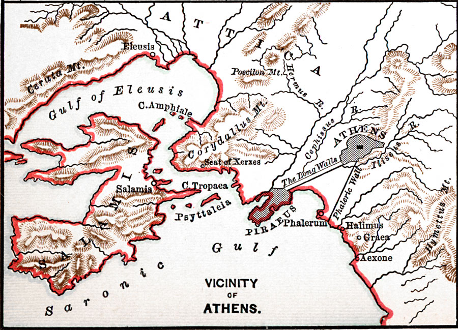
Description: A map of the vicinity of Athens and Piraeus around 450 BCE, showing the strategic long walls between Athens and the ports of Piraeus and Phalerum, rivers, mountains, and Salamis Island between the Gulf of Eleusis and Saronic Gulf.
Place Names: Greece,
ISO Topic Categories: oceans,
location,
inlandWaters,
structure
Keywords: Vicinity of Athens, physical, �political, physical features, local jurisdictions, oceans,
location,
inlandWaters,
structure, Unknown, 450 BCE
Source: John Clark Ridpath, Cyclopedia of Universal History (Cincinnati, OH: The Jones Brothers Publishing Co., 1885) 481
Map Credit: Courtesy the private collection of Roy Winkelman |
|