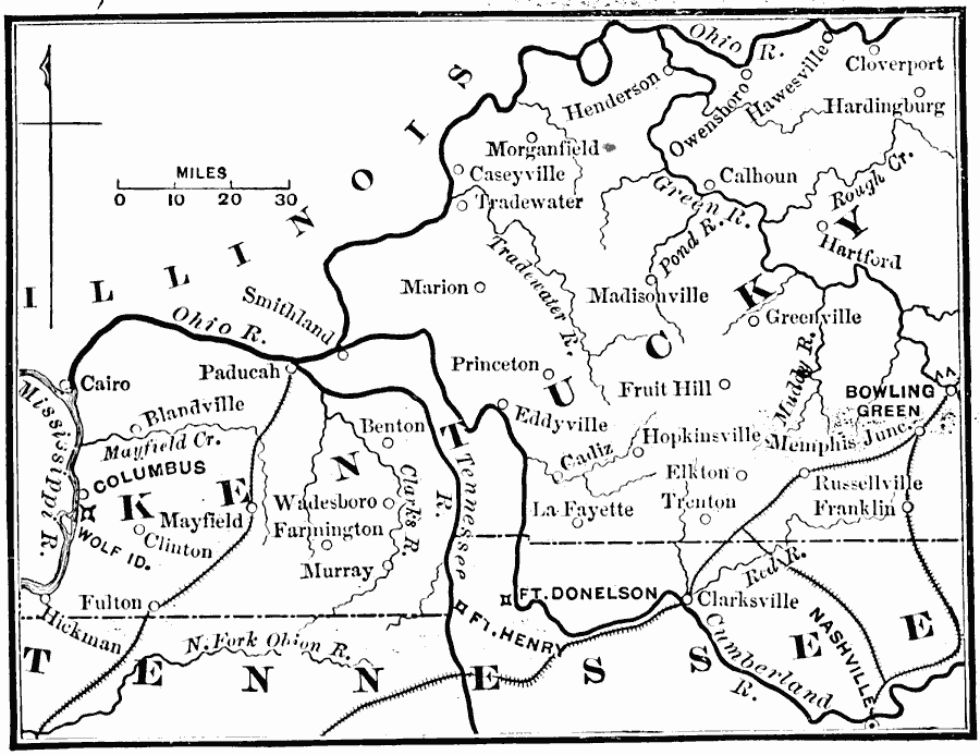
Description: A map of central Kentucky showing the Confederate territory in 1862. ":The opening of 1862 found the Confederates in possession of a strong line across the southern portion of Western Kentucky, stretching from Bowling Green, near the center of the State, to Columbus on the Mississippi. The two gates of this line were Forts Henry and Donaldson, on the Tennessee and Cumberland Rivers, respectively, just over the Tennessee border. If these forts could be taken the Confederates must give up Kentucky." — Andrews, 1895, p. 18.
Place Names: Civil War, Bowling Green, �Clinton, �Kentucky, �Illinois, �Tenessee, �Confederate territor
ISO Topic Categories: boundaries,
location,
inlandWaters,
intelligenceMilitary
Keywords: Confederate Line in Kentucky, physical, �political, �transportation, �historical, physical features, major political subdivisions, railroads, Civil War, boundaries,
location,
inlandWaters,
intelligenceMilitary, Unknown, 1862
Source: E. Benjamin Andrews, History of the United States Vol IV (New York, NY: Charles Scribner's Sons, 1895) 18
Map Credit: Courtesy the private collection of Roy Winkelman |
|