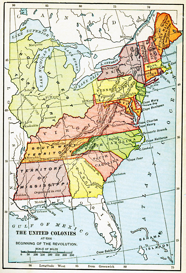
Description: A map of the United Colonies at the beginning of the American Revolution (1776) showing colonial land claims to the Mississippi River, including the territories organized after the war. The map shows the Northwest Territory (organized in 1787), Province of Maine (belonged to Massachusetts until 1820), the Southwest Territory (belonged to North Carolina until 1790), and the Territory of Mississippi (organized in 1802).
Place Names: Early America 1400-1800, Boston, �New York, �Pittsburg, �Springfield, �Raleigh, �Savannah, �Albany, �Annapolis, �American Revolution, �Colonial Americ
ISO Topic Categories: oceans,
location,
inlandWaters,
boundaries
Keywords: The United Colonies, historical, �political, �physical, physical features, country borders,
major political subdivisions, American Revolution, oceans,
location,
inlandWaters,
boundaries, Unknown, 1776
Source: E. Benjamin Andrews, History of the United States Vol II (New York, NY: Charles Scribner's Sons, 1913) 67
Map Credit: Courtesy the private collection of Roy Winkelman |
|