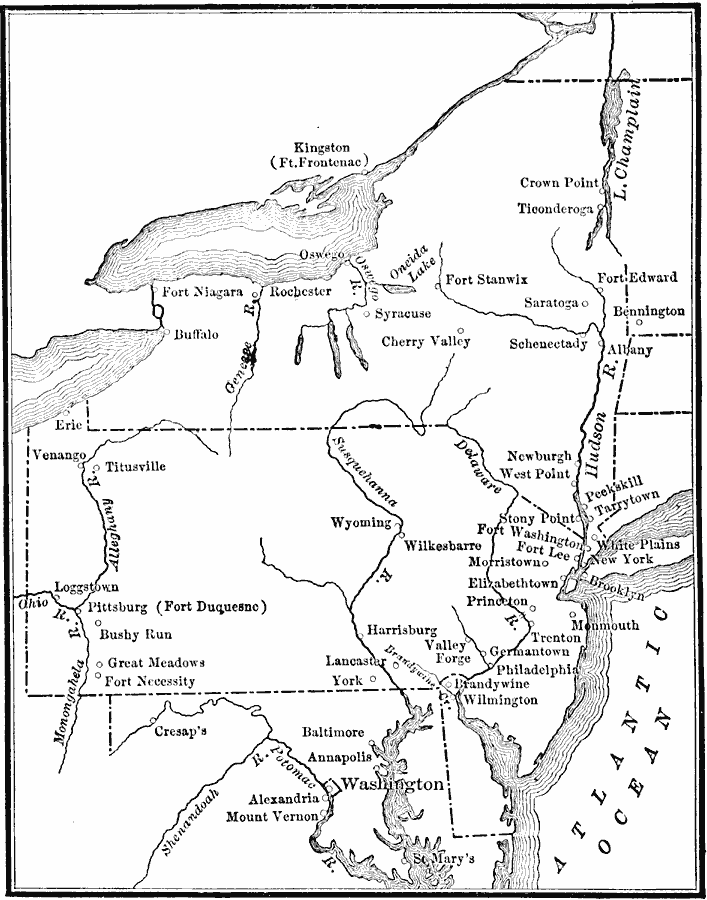
Description: A map of the Middle States during the American Revolutionary War showing the major northern battle sites from Crown Point on Lake Champlain south to Brandywine and west to Pittsburgh (Fort Duquesne) and Venago.
Place Names: Early America 1400-1800, New York, �Philadelphia, �Pittsburg, �Buffalo, �Albany, �Syracuse, �Washington, �Mount Vernon, �Trenton, �Atlantic States, �Mid-Atlantic States, �East Coas
ISO Topic Categories: inlandWaters,
location,
oceans,
boundaries
Keywords: Middle Atlantic States, physical, �political, �historical, physical features, major political subdivisions, American Revolution, inlandWaters,
location,
oceans,
boundaries, Unknown, 1778–1779
Source: Charles Kendall Adams, A History of the United States (Boston, MA: Allyn and Bacon, 1909) 145
Map Credit: Courtesy the private collection of Roy Winkelman |
|