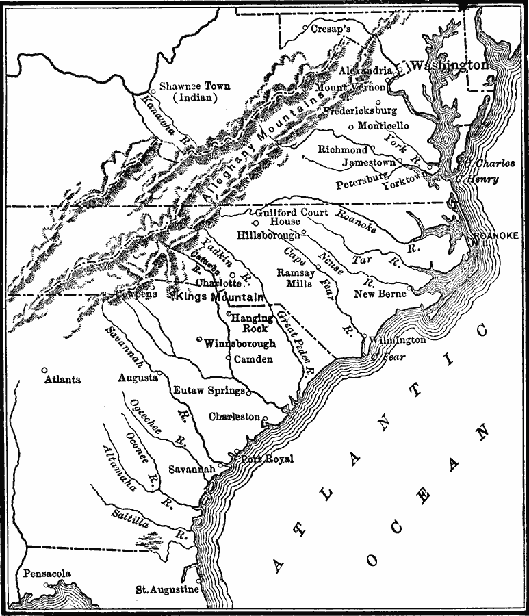
Description: A map showing the southern operations (1780–1781) during the American Revolutionary War. The map shows terrain, rivers, and major battle sites from the northern Virginia line south to St. Augustine, which was at the time a Loyalist colony under Britain as established by the Treaty of 1763.
Place Names: Early America 1400-1800, Charlotte, �Atlanta, �St. Augustine, �Washington, �Atlantic States, �East Coast, �Mid-Atlantic State
ISO Topic Categories: inlandWaters,
location,
oceans,
intelligenceMilitary
Keywords: Operations in the South during the American Revolutionary War, physical, �political, �historical, kAmericanRevolution,physical features, major political subdivisions, American Revolution, inlandWaters,
location,
oceans,
intelligenceMilitary, Unknown, 1780–1781
Source: Charles Kendall Adams, A History of the United States (Boston, MA: Allyn and Bacon, 1909) 170
Map Credit: Courtesy the private collection of Roy Winkelman |
|