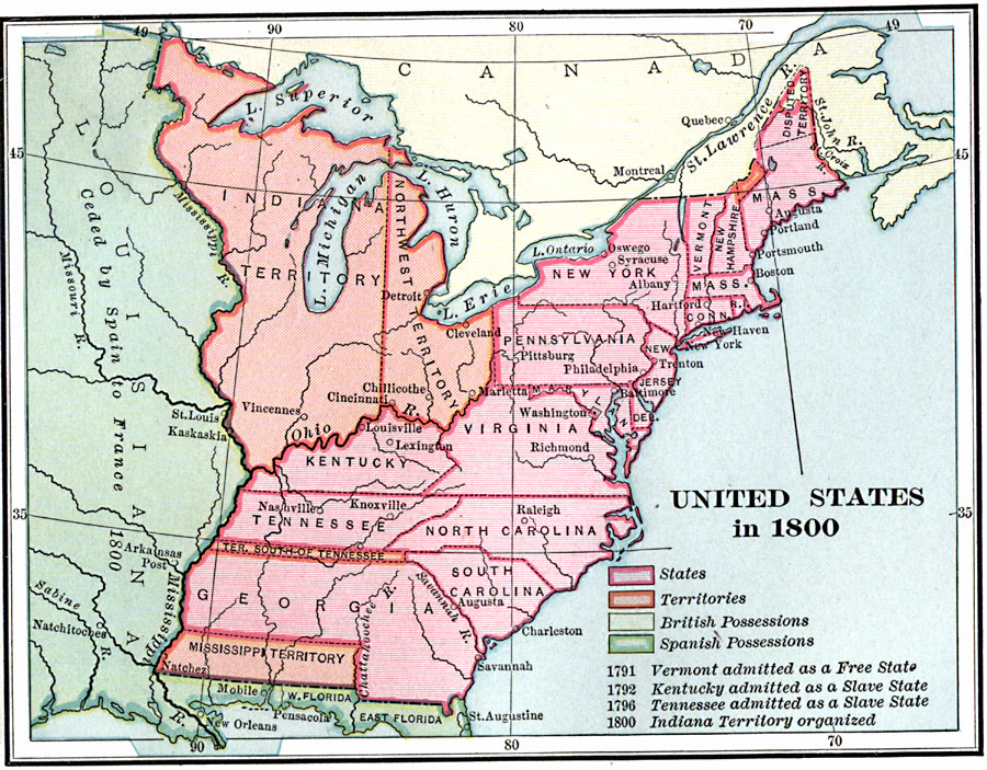
Description: A map of the United States in 1800, color–coded to show the States, Territories, British possessions, and Spanish possessions. The map shows State and Territory boundaries at the time, the disputed territory in northern Massachusetts (Maine), and notes the admittance of Vermont, Kentucky, and Tennessee as either Free State or Slave State, and the organization of the Indiana Territory. The map also notes the Spanish territory west of the Mississippi River ceded to France in 1800.
Place Names: Early America 1400-1800, Boston, �New York, �Washington D.C., �Richmond, �Raleigh, �Savannah, �Charleston, �Syracuse, �Trenton, �Colonial America, �English, �Native Americans, �Spanis
ISO Topic Categories: boundaries,
location,
oceans,
inlandWaters
Keywords: United States, physical, �political, physical features, major political subdivisions, boundaries,
location,
oceans,
inlandWaters, Unknown, 1800
Source: Charles Kendall Adams, A History of the United States (Boston, MA: Allyn and Bacon, 1909) 211
Map Credit: Courtesy the private collection of Roy Winkelman |
|
