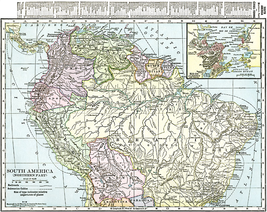
Description: A map from 1920 of the northern part of South America from the Caribbean Sea south the Rio de Janeiro. The map shows the political boundaries at the time for Panama, Columbia, Venezuela, British, Dutch, and French Guiana, Ecuador, Peru, and Bolivia, the northern portion of Brazil, and portions of Chile, Argentina, and Paraguay. The map shows capitals and major cities, towns, ports, railroads, submarine telegraph cables, rivers, terrain, and coastal features. An inset map details Rio de Janeiro and the Bay of Rio de Janeiro on the Atlantic coast of Brazil. A grid reference key of important cities and towns of the region is given at the top of the map.
Place Names: A Regional Map of South America, Bogota, �Bolivia, �Brazil, �Caracas, �Colombia, �Ecuador, �Guiana, �La Paz, �Lima, �Peru, �Venezuel
ISO Topic Categories: oceans,
location,
inlandWaters
Keywords: Northern Part of South America, borders, �political, �transportation, country borders,
county borders, railroads, oceans,
location,
inlandWaters, Unknown, 1920
Source: , The New Reference Atlas of the World - A New Series of Physical, Political and Historical Maps compiled from Government Surveys and exhibiting the Latest Results of Geographical Research (New York, NY: C. S. Hammond & Company, 1920) 24
Map Credit: Courtesy the private collection of Roy Winkelman |
|