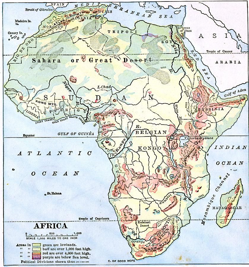
Description: A map of the African continent showing general color–coded elevations, including areas below sea level in purple, lowlands in green, elevations above 1,000 feet in buff, and elevations over 4,000 feet in red. Political divisions of the time are shown, as well as major rivers, lakes, and mountain systems.
Place Names: A Complete Map of Africa, Algeria, �Madagascar, �Union of South Africa, �Belgian Kongo, �Abyssinia, �Guinea, �Morocco, �Tripoli,
ISO Topic Categories: elevation,
location,
inlandWaters,
oceans
Keywords: Elevations of Africa, physical, physical features, elevation,
location,
inlandWaters,
oceans, Unknown, 1906
Source: Alexis Everett Frye, Frye's First Steps in Geography (Boston, Massachusetts: Ginn and Company, 1906) 129
Map Credit: Courtesy the private collection of Roy Winkelman |
|