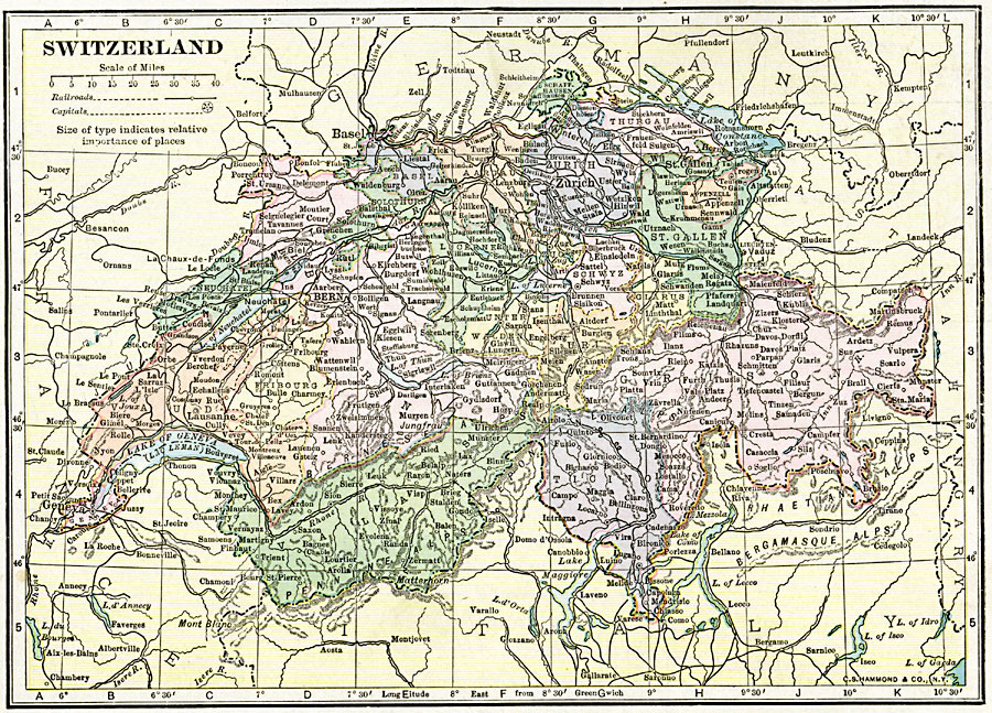
Description: A map of Switzerland in 1920, showing major cities and towns, railroads, rivers, lakes, and terrain. The map is color–coded to show the Cantons (and capital cities) of Switzerland.
Place Names: Switzerland, Basel, �Bern, �Biel, �Chur, �Fribourg, �Geneva, �Lausanne, �Lugano, �Winterthur, �Zuric
ISO Topic Categories: oceans,
location,
inlandWaters,
boundaries
Keywords: Switzerland, borders, �political, �transportation, country borders,
county borders, railroads,
water routes, oceans,
location,
inlandWaters,
boundaries, Unknown, 1920
Source: , The New Reference Atlas of the World - A New Series of Physical, Political and Historical Maps compiled from Government Surveys and exhibiting the Latest Results of Geographical Research (New York, NY: C. S. Hammond & Company, 1920) 49
Map Credit: Courtesy the private collection of Roy Winkelman |
|