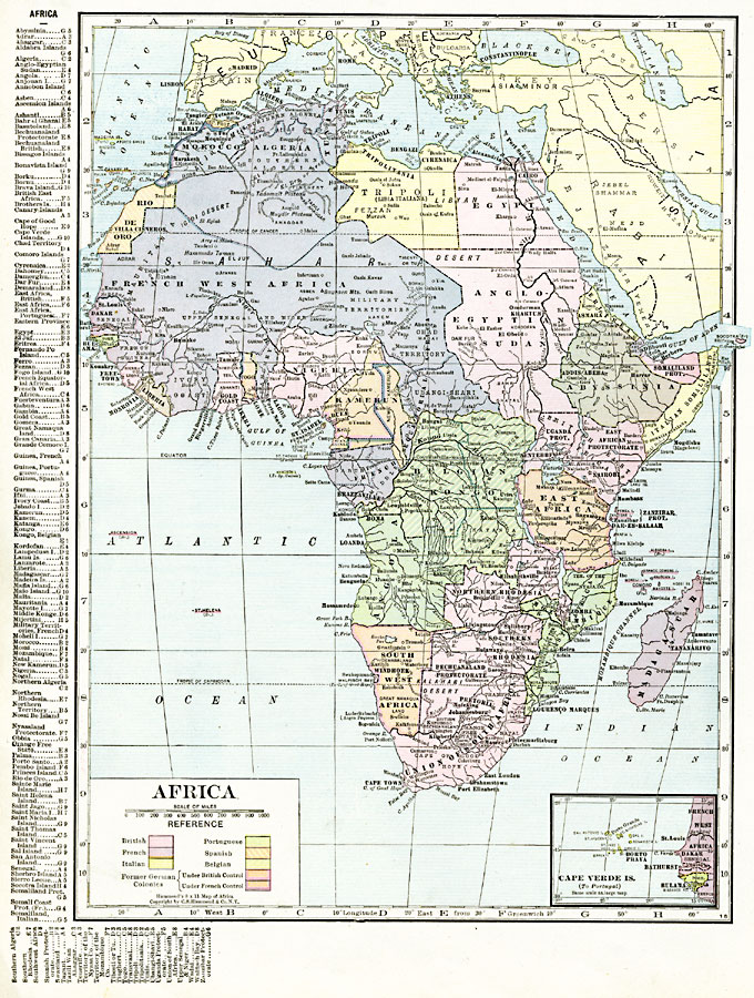
Description: A political map of Africa in 1920 showing colonial possessions of the British, French, Italian, Portuguese, Spanish, and Belgians, including the former German colonies, lost after WWI, per the Treaty of Versailles. The map shows major cities, rivers, and landforms, and an inset map of the Cape Verde Islands under Portuguese control. This map also has a list of place names with location grid reference on the left edge.
Place Names: A Complete Map of Africa, Algeria, �Congo, �Egypt, �Ethiopia, �Lybia, �Madagascar, �Nigeria, �Somalia, �South Africa, �Suda
ISO Topic Categories: oceans,
location,
inlandWaters,
boundaries
Keywords: Post-WWI Africa, borders, �political, �transportation, kBerlinConference, kVersailles, country borders,
county borders, railroads,
water routes, oceans,
location,
inlandWaters,
boundaries, Unknown, 1920
Source: , The New Reference Atlas of the World - A New Series of Physical, Political and Historical Maps compiled from Government Surveys and exhibiting the Latest Results of Geographical Research (New York, NY: C. S. Hammond & Company, 1920) 50
Map Credit: Courtesy the private collection of Roy Winkelman |
|