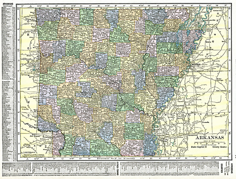
Description: A map of Arkansas from 1920 showing the State capital of Little Rock, counties and county seats, major cities and towns, railroads, mountains, lakes, and rivers. A grid reference in the margins of the map lists counties, principal cities, and towns.
Place Names: Arkansas, Benton, �Clinton, �Fayetteville, �Fort Smith, �Helena, �Hot Springs, �Jonesboro, �Little Rock, �Pine Bluff, �Texarkan
ISO Topic Categories: oceans,
location,
inlandWaters,
boundaries
Keywords: Arkansas, borders, �political, �physical, country borders,
county borders, oceans,
location,
inlandWaters,
boundaries, Unknown, 1920
Source: , The New Reference Atlas of the World - A New Series of Physical, Political and Historical Maps compiled from Government Surveys and exhibiting the Latest Results of Geographical Research (New York, NY: C. S. Hammond & Company, 1920) 99
Map Credit: Courtesy the private collection of Roy Winkelman |
|