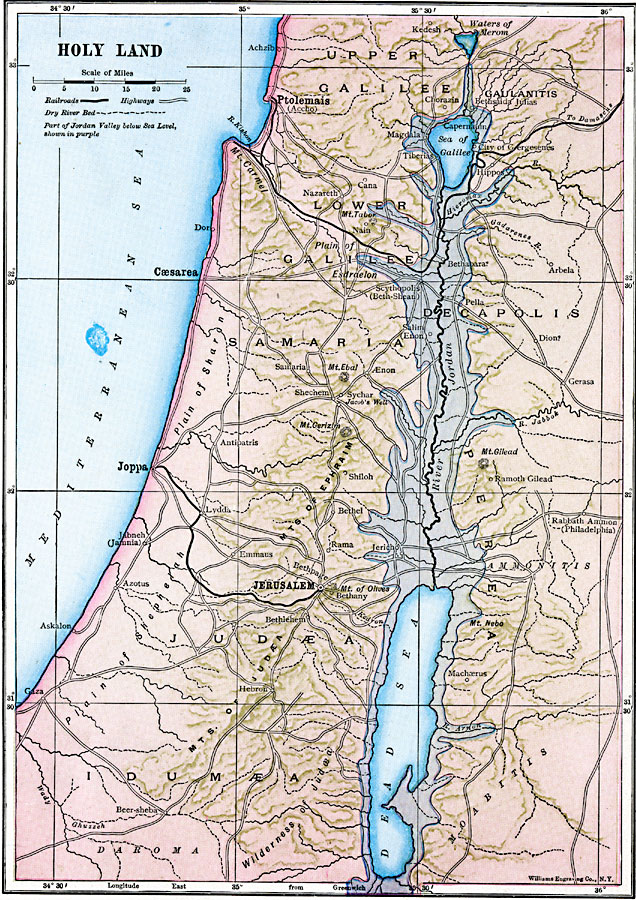
Description: A map from 1910 of the Holy Land, generally referred to as the geographical region of the Levant. This map shows the territories of Upper Galilee, Lower Galilee, Decapolis, Samaria, Perea, Judæa, and Idumæa, and shows major cities, railroads, highways, terrain and historical mountains and plains, rivers and dry river beds, the Waters of Merom, Sea of Galilee, and Dead Sea, coastal features, and is color–coded to show the land which lies below sea level.
Place Names: Israel, Caesarea, �Decapolis, �Galilee, �Gaulanitis, �Idumaea, �Judaea, �Jerusalem, �Perea, �Ptolemais, �Samaria,
ISO Topic Categories: oceans,
location,
inlandWaters,
boundaries
Keywords: Holy Land, transportation, water routes,
railroads, oceans,
location,
inlandWaters,
boundaries, Unknown, 1910
Source: Ralph S. Tarr, B.S., F.G.S.A. and Frank M. McMurry, Ph.D., New Geographies (Second Book) (New York , NY: The MacMillan Company, 1910) 348
Map Credit: Courtesy the private collection of Roy Winkelman |
|