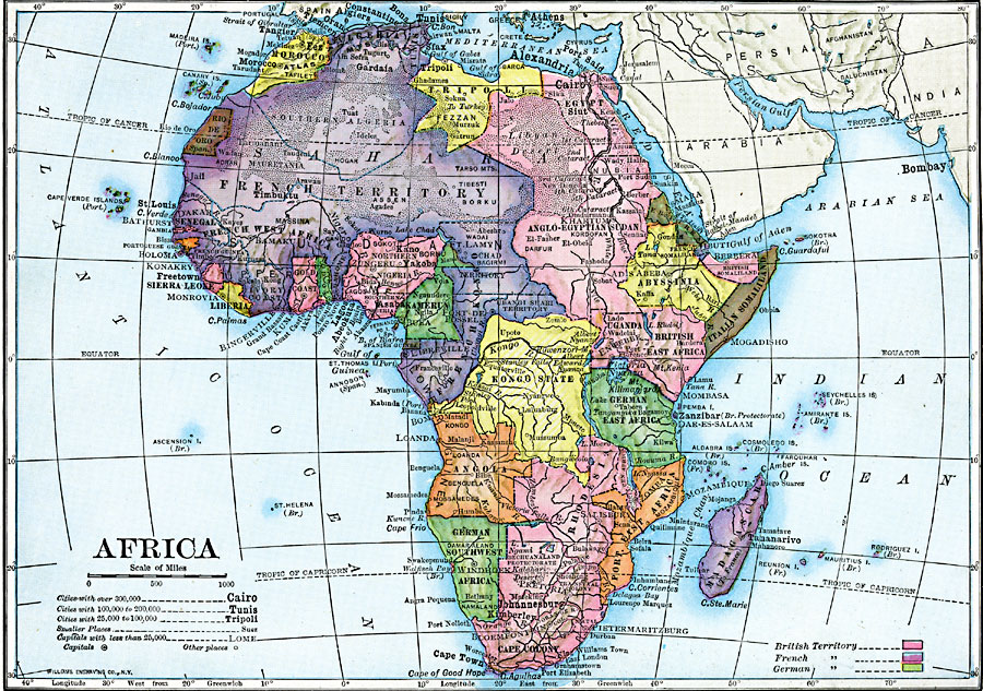
Description: A map of Africa after the Berlin Conference of 1885, which established the European colonial territory claims on the continent. This map shows the British, French, German, Italian, Portuguese, and Spanish claims, and the Ottoman possession of Tripoli. This map also shows the Caprivi Strip, a strategic corridor linking German Southwest Africa to the Zambizi River in what was then Rhodesia, and thereby access to the west coast of Africa and the territory of German East Africa. Capital and major cities are shown, as well as major rivers and landforms.
Place Names: A Complete Map of Africa, Abyssinia, �Algeria, �Anglo-Egyptian Sudan, �Angola, �Congo, �Egypt, �Ethiopia, �Johannesburg, �Kamerun, �Kongo, �Libya, �Madagascar, �Morocco, �Nigeria, �Rhodesia, �Somalia, �Sudan, �Tripoli, �Ugand
ISO Topic Categories: oceans,
location,
inlandWaters,
boundaries
Keywords: Colonial Africa, physical, �transportation, kBerlinConference, topographical, country borders, water routes, oceans,
location,
inlandWaters,
boundaries, Unknown, 1910
Source: Ralph S. Tarr, B.S., F.G.S.A. and Frank M. McMurry, Ph.D., New Geographies (Second Book) (New York , NY: The MacMillan Company, 1910) 372
Map Credit: Courtesy the private collection of Roy Winkelman |
|