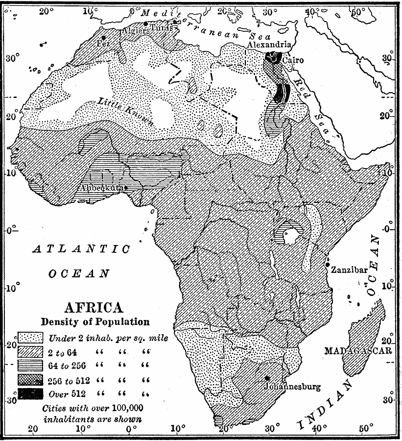
Description: Map showing the population density of Africa in 1910 measured in inhabitants per square mile. Cities with populations over 100,000 are shown.
Place Names: A Complete Map of Africa, Abyssinia, �Alexandria, �Algeria, �Anglo-Egyptian Sudan, �Angola, �Cairo, �Congo, �Egypt, �Ethiopia, �Johannesburg, �Kamerun, �Kongo, �Libya, �Madagascar, �Morocco, �Nigeria, �Rhodesia, �Somalia, �Sudan, �Tripoli, �Uganda, �Zanziba
ISO Topic Categories: oceans,
location,
inlandWaters
Keywords: Africa - Density of Population, statistical, kPopulation, population, oceans,
location,
inlandWaters, Unknown, 1910
Source: Ralph S. Tarr, B.S., F.G.S.A. and Frank M. McMurry, Ph.D., New Geographies (Second Book) (New York , NY: The MacMillan Company, 1910) 376
Map Credit: Courtesy the private collection of Roy Winkelman |
|