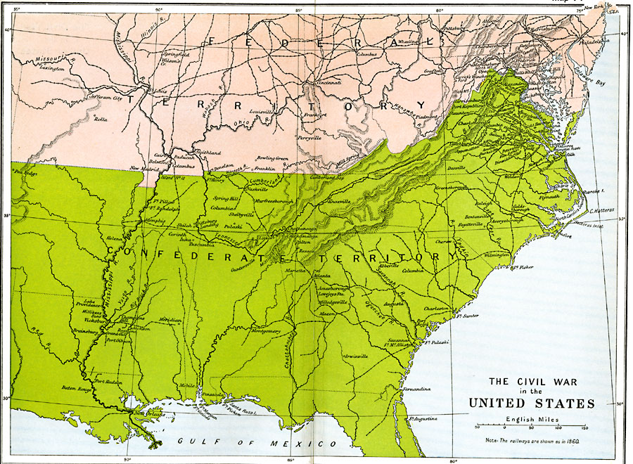
Description: A map of the southeastern States showing the Federal and Confederate territories at the end of 1861. The railroad network shown is based on 1860 lines. The map shows major cities, mountain systems, rivers, and coastal features of the area.
Place Names: Civil War, confederate, �federal, �Boston, �Chicago, �Florida, �Louisiana, �New Orleans, �New York, �United States, �Confederate territory, �Federal territor
ISO Topic Categories: oceans,
location,
inlandWaters,
boundaries
Keywords: The Civil War in the United States, political, �historical, �transportation, local jurisdictions,
country borders,
major political subdivisions, railroads, Civil War, oceans,
location,
inlandWaters,
boundaries, Unknown, 1861
Source: Ward, Prothero, and Leathes, The Cambridge Modern History Atlas (New York, NY: The Macmillan Company, 1912)
Map Credit: Courtesy the private collection of Roy Winkelman |
|