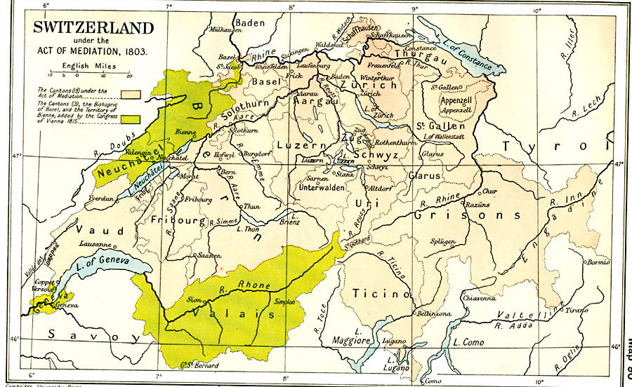
Description: A map of Switzerland in 1803, under the Act of Mediation issued by Napoleon establishing the Swiss Confederation. This map is color–coded to show the nineteen Cantons under the Act in tan, and the three Cantons, the Bishopric of Basel, and the Territory of Bienne, added by the Congress of Vienna (1815) in green. The map shows major cities, rivers, and lakes of the area.
Place Names: Switzerland, Basel, �Bern, �Fribourg, �Grisons, �Lausanne, �Schwyz, �Ticino, �Uri, �Zuric
ISO Topic Categories: oceans,
location,
inlandWaters,
boundaries
Keywords: Switzerland, political, �historical, country borders,
major political subdivisions,
local jurisdictions, historical event, oceans,
location,
inlandWaters,
boundaries, Unknown, 1803–1815
Source: Ward, Prothero, and Leathes, The Cambridge Modern History Atlas (New York, NY: The Macmillan Company, 1912)
Map Credit: Courtesy the private collection of Roy Winkelman |
|