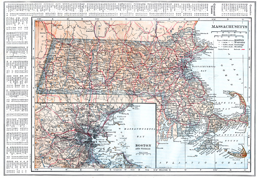
Description: A map from 1914 of Massachusetts showing the capital Boston, major cities, towns, and ports, counties and county seats, railroads, mountains, lakes, rivers, and coastal islands and features. An inset map details the vicinity of Boston. A grid reference in the margins of the map lists counties, principal cities, and towns of Massachusetts.
Place Names: Massachusetts, Fall River, �Boston, �Cape Cod, �Cambridge, �Worchester, �North Bedford, �Nantucket, �Lowell, �Salem, �Springfiel
ISO Topic Categories: boundaries,
inlandWaters,
location,
oceans,
transportation
Keywords: Massachusetts, physical, �political, �transportation, physical features, county borders, railroads, boundaries,
inlandWaters,
location,
oceans,
transportation, Unknown, 1914
Source: , The New Encyclopedic Atlas and Gazetteer of the World (New York, NY: P. F. Collier and Son, 1914) 28
Map Credit: Courtesy the private collection of Roy Winkelman |
|