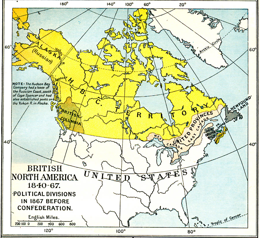
Description: A map of British America (Canada) between the Act of Union (1840) which merged East Canada and West Canada into the United Provinces, and the British North America Act of 1867 which formed the confederation of Canada. The map is color–coded to show the United Provinces (with East Canada and West Canada shown), the Hudson Bay Company Territory, the provinces of Nova Scotia and New Brunswick, which joined the United Provinces in 1867, British Columbia, which joined in 1871, Prince Edward Island, which joined in 1873, and Newfoundland, which joined in 1949. The map shows the Alaska territory as a possession of Russia at the time, with a map note that the Hudson Bay Company had a lease of the Russian Coast, south of Cape Spenser and had also established posts on the Yukon River in Alaska.
Place Names: Canada, Canada, �Newfoundland, �United State
ISO Topic Categories: oceans,
location,
inlandWaters,
boundaries
Keywords: British North America, political, country borders,
local jurisdictions,
major political subdivisions, oceans,
location,
inlandWaters,
boundaries, Unknown, 1840–1867
Source: Ward, Prothero, and Leathes, The Cambridge Modern History Atlas (New York, NY: The Macmillan Company, 1912)
Map Credit: Courtesy the private collection of Roy Winkelman |
|