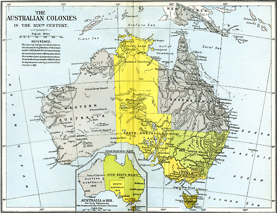
Description: Map of the Australian Colonies in the 19th Century. This color–coded map "distinguishes the six colonies which became the 'Original States' of the Commonwealth in 1900. (British New Guinea, annexed by the Imperial Government in 1884, was administered for a number of years by Queensland and transferred to the Commonwealth in 1906). Northern Territory was placed under the jurisdiction of South Australia in 1863." The inset map shows the early settlement boundaries in 1885, with the dates of each colony formation shown. According to this map, the original New South Wales was formed in 1786, Tasmania in 1825, Western Australia in 1829, South Australia in 1836, and Victoria in 1851.
Place Names: A Complete Map of Australia, Alice Springs, �Brisbane, �Cairns, �Canberra, �Darwin, �Mackay, �Melbourne, �Newcastle, �Queensland, �Sydney, �Townsville, �Victoria, Perth, Hobart
ISO Topic Categories: oceans,
location,
inlandWaters,
boundaries
Keywords: The Australian Colonies, political, country borders,
local jurisdictions,
major political subdivisions, oceans,
location,
inlandWaters,
boundaries, Unknown, 1786–1900
Source: Ward, Prothero, and Leathes, The Cambridge Modern History Atlas (New York, NY: The Macmillan Company, 1912)
Map Credit: Courtesy the private collection of Roy Winkelman |
|