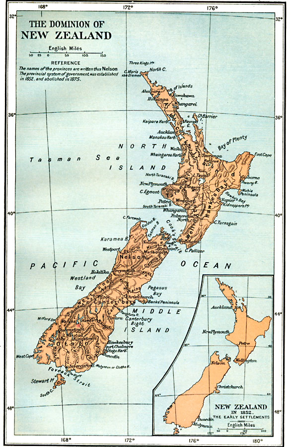
Description: A map of New Zealand from 1912 showing provinces, cities, towns, ports, mountain ranges, rivers, lakes, and coastal features. The map notes that the provincial system of government was established in 1852, and abolished in 1875. An inset map shows early European settlements of New Zealand in 1852, including Auckland, New Plymouth, Petre, Wellington, Nelson, Christchurch, Dunedin, and Molyneux.
Place Names: New Zealand, Auckland, �Christchurch, �Gisborne, �Greymouth, �Hamilton, �Napier, �New Plymouth, �Palmerston North, �Tauranga, �Wellingto
ISO Topic Categories: oceans,
location,
inlandWaters,
boundaries
Keywords: The Dominion of New Zealand, political, country borders,
local jurisdictions,
major political subdivisions, oceans,
location,
inlandWaters,
boundaries, Unknown, 1912
Source: Ward, Prothero, and Leathes, The Cambridge Modern History Atlas (New York, NY: The Macmillan Company, 1912)
Map Credit: Courtesy the private collection of Roy Winkelman |
|