Maps Site map
  Maps > Australia > New Zealand
Site Map  

  Record   1   to   8  of   8

Historic and contemporary maps of New Zealand for use in the K-12 classroom.
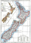
New Zealand, 1903
A map of New Zealand from 1903 showing counties, cities, mountain ranges, rivers, and railroads. The map has a reference key for locating the 63 counties established in 1876. The map includes a color–coded inset map showing the geological areas...

New Zealand, 1904
A geo–political map of New Zealand current to 1904, showing major cities, railroad lines, and navigable rivers. Physical features include mountain ranges with elevation measured in feet, major rivers and watersheds, and the 100–fathom lin...

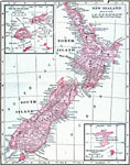
New Zealand, 1906
A map from 1906 showing the islands of New Zealand. In 1876 New Zealand abolished the provinces established by early European settlers, however this map shows the regional local entities of Auckland, Hawke's Bay, Taranaki, and Wellington on the North...

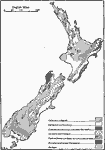
Geologic Map of New Zealand, 1911
A map from 1911 of New Zealand, showing levels of geological strata...

The Dominion of New Zealand, 1912
A map of New Zealand from 1912 showing provinces, cities, towns, ports, mountain ranges, rivers, lakes, and coastal features. The map notes that the provincial system of government was established in 1852, and abolished in 1875. An inset map shows ea...

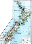
New Zealand, 1915
A map from 1915 of New Zealand showing main economic products, major cities and ports, principal railways, terrain, lakes, rivers, and coastal features. This map is color–coded to show the areas of livestock and vineyard production, and areas w...

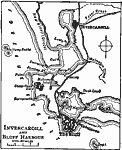
Invercargill and Bluff Harbor, 1919
A map from 1919 showing Invercargill and Bluff Harbor at the southern tip of New Zealand's South Island. This map shows railways, rivers, coastal features, the Foveaux Strait between the South Island and Stewart Island, and the neighboring towns of O...

Dominion of New Zealand, 1920
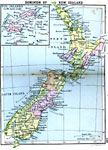
A map from 1906 showing the Dominion of New Zealand with a detail inset of the Fiji Islands. In 1876 New Zealand abolished the provinces established by early European settlers, however this map shows the regional local entities of Northland, Auckland...


  Maps > Australia > New Zealand
Site Map  

Maps ETC is a part of the Educational Technology Clearinghouse
Produced by the Florida Center for Instructional Technology © 2009
College of Education, University of South Florida