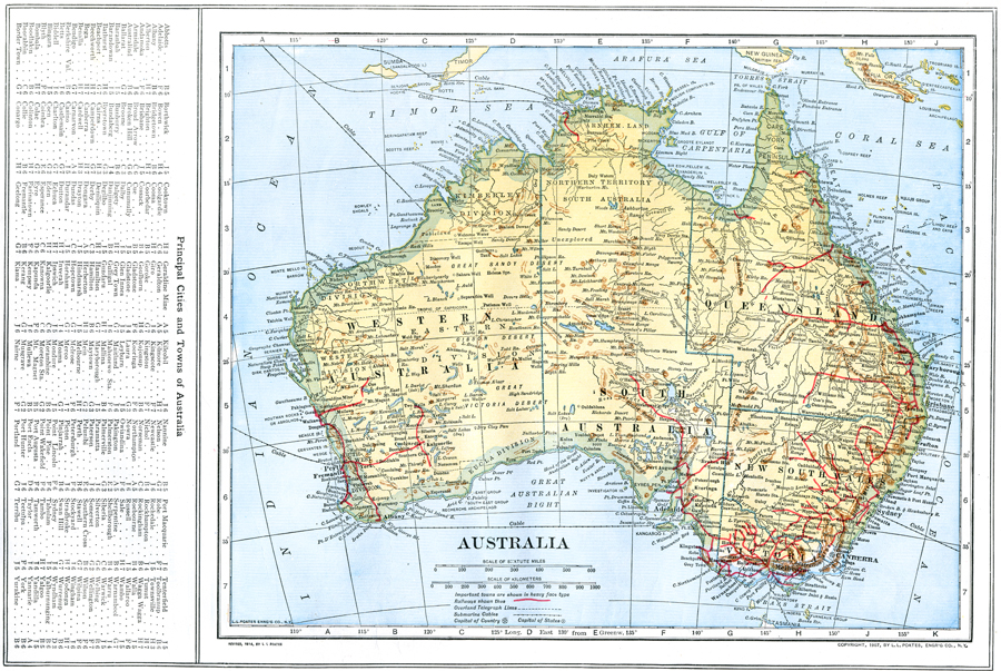
Description: A map of Australia in 1914 showing states, territories, and divisions, major towns and cities, rivers, mountains, railways, overland telegraph routes, submarine cables, and steamship routes. This map also has a list of principle cities and towns of Australia with location grid reference on the left edge.
Place Names: A Complete Map of Australia, Canberra, �Brisbane, �Sydney, �Melbourne, �Cairns, �Townsville, �Newcastle, Great Barrier Reef
ISO Topic Categories: boundaries,
inlandWaters,
location,
oceans,
transportation
Keywords: Australia, physical, �political, �transportation, physical features, county borders, railroads, boundaries,
inlandWaters,
location,
oceans,
transportation, Unknown, 1914
Source: , The New Encyclopedic Atlas and Gazetteer of the World (New York, New York: P. F. Collier and Son, 1914) 72
Map Credit: Courtesy the private collection of Roy Winkelman |
|