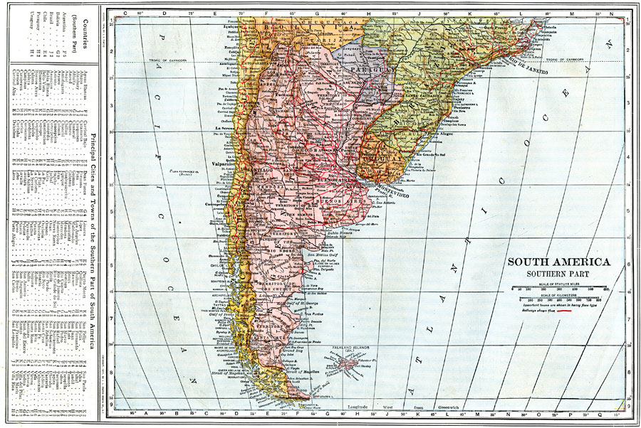
Description: A map from 1914 of the southern part of South America from Victoria, Brazil on the Atlantic and Iquique, Chile on the Pacific south to Tierra del Fuego. The map shows the political boundaries at the time for Argentina, Paraguay, Uruguay, and the southern portions of Chile, Bolivia, and Brazil. This map shows the Falkland Islands (Islas Malvinas) as a British possession. The map shows capitals and major cities, towns, ports, railroads, rivers, terrain, and coastal features. A grid reference key of the countries, important cities and towns of the region is given at the side of the map.
Place Names: A Regional Map of South America, Argentina, �Chile, �Uraguay, �Brazil, �Paraguay, �Bolivia, �Falkland Islands,
ISO Topic Categories: boundaries,
inlandWaters,
location,
oceans,
transportation
Keywords: Southern South America, physical, �political, �transportation, physical features, country borders, railroads, boundaries,
inlandWaters,
location,
oceans,
transportation, Unknown, 1914
Source: , The New Encyclopedic Atlas and Gazetteer of the World (New York, New York: P. F. Collier and Son, 1914) 75
Map Credit: Courtesy the private collection of Roy Winkelman |
|