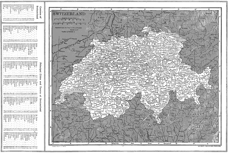
Description: Map of Switzerland in 1914, showing major cities, railroads, waterways and canals, rivers, lakes, and terrain. The map has a grid–reference key to the cantons, principal cities and towns of Switzerland.
Place Names: Switzerland, Basel, �Chur, �Fribourg, �Lausanne, �Geneva, �Lugano, �Winterthur, �Zurich, �Berne,
ISO Topic Categories: boundaries,
location,
inlandWaters,
transportation
Keywords: Switzerland, physical, �political, �transportation, physical features, country borders, water routes, boundaries,
location,
inlandWaters,
transportation, Unknown, 1914
Source: , The New Encyclopedic Atlas and Gazetteer of the World (New York, New York: P. F. Collier and Son, 1914) 136
Map Credit: Courtesy the private collection of Roy Winkelman |
|