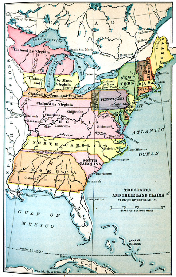
Description: A map of the United States at the close of the American Revolutionary War showing the newly formed States, and their claims to the lands west of the Allegheny Mountains to the Mississippi River. The map shows the territories jointly claimed by the States, the portion of New Hampshire also claimed by New York (eventually becoming Vermont), and the territory in dispute between Georgia and Spain.
Place Names: Early America 1400-1800, Boston, �Connecticut, �Delaware, �Georgia, �New Hampshire, �New Jersey, �New York, �North Carolina, �South Carolina, �Virginia, �American Revolutio
ISO Topic Categories: oceans,
location,
inlandWaters,
boundaries
Keywords: The States and their Land Claims at close of Revolution, political, �transportation, �historical, local jurisdictions, water routes,
roads, other military, oceans,
location,
inlandWaters,
boundaries, Unknown, 1783
Source: Jacques W. Redway, F.R.G.S., The Redway School History (New York, NY: Silver, Burdett and Company, 1911)
Map Credit: Courtesy the private collection of Roy Winkelman |
|