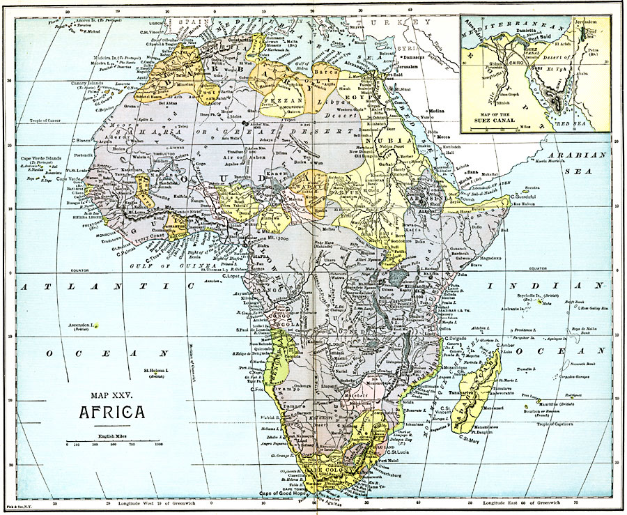
Description: A map of the African continent prior to the Berlin Conference of 1885, when the most powerful countries in Europe at the time convened to make their territorial claims on Africa and establish their colonial borders at the start of the New Imperialism period. This map shows the native African States of Morocco, Algeria, Tunis, Tripoli, and Fezzan in the Barbary region, Egypt, Nubia, Darfur, Kordofan, Abyssinia, and Somauli Land in the northeast, Sokoto, Bornu, Bagjimi, Waday, Lower Guinea, and Zanguebar in central Africa, Aderer, Senegambia, Liberia, Bambarra, Masina, Ashantee, Gold Coast, Dahomey, and Houssa in western Africa, and Benguela, Matabeli, Mozambique, Sofala, Zulu Land and Kaffraria in the south. The European possessions of Cape Colony, Orange River Free State, and Transvaal are shown. Several of the larger native group names are shown on the map, as well as major cities and trade centers, rivers, deserts, and mountain systems. An inset map details the Suez Canal, and the railroad routes between Suez and Alexandria and along the Nile River from Minieh to Cairo.
Place Names: A Complete Map of Africa, Egypt, �Nubia, �Abyssinia, �Madagascar, �Zanguebar, �Mozambique, �Cape Colony, �Benguela, �Congo Angola, �Guinea, �Liberia, �Congo, �Marocco, �Algeria, �Tunis, �Souda
ISO Topic Categories: boundaries,
inlandWaters,
location,
oceans,
transportation
Keywords: Pre-Colonial Africa, physical, �political, �transportation, kAfricanNativeStates, kBerlinConference, kSuezCanal, physical features, country borders, water routes, boundaries,
inlandWaters,
location,
oceans,
transportation, Unknown, 1885
Source: John Clark Ridpath LL. D., Cyclopedia of Universal History (Cincinnati, Ohio: Jones Brothers Publishing Co., 1885) 1226-1227
Map Credit: Courtesy the private collection of Roy Winkelman |
|