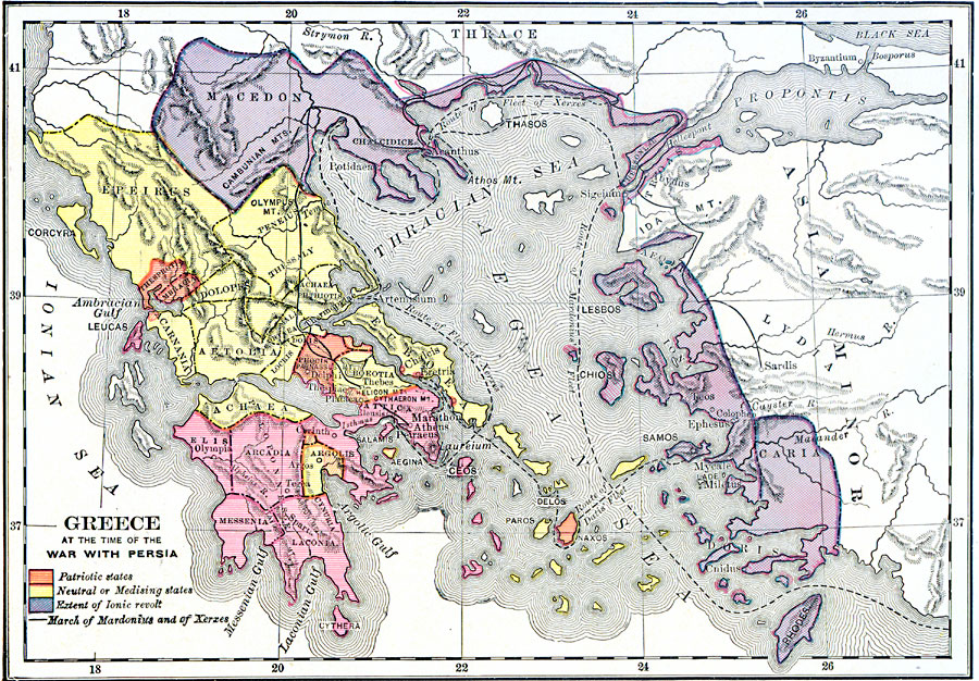
Description: A map of Greece and Asia Minor at the time of the wars with Persia (Greco–Persian Wars, 499–479 BC). The map is color–coded to show the extent of the Ionian Revolt (499–493 BC) from Macedonia along the coast of Asia Minor to the island of Rhodes (purple), the neutral or "medising" states of Argolis, Achaea, Euboea, Boeotia, and central peninsular states (yellow), and the patriotic states, outlined in orange. The map shows the routes of the Persian fleets under Mardonius (492 BC), Datis (490 BC) to Marathon, and Xerxes during the second Persian invasion of Greece (480–479 BC). The map shows the routes of the Persian Army under Mardonius across Thrace and Macedonia, and under Xerxes across Hellespont, Thrace, Macedonia, and south toward Athens. The map shows the battle sites of Thermopylae, Artemisium, Salamis, and Plataea.
Place Names: Greece, Athens, �Olympia, �Sparta, �Thebes, �Corinth, �Delphi, �Lesbos, �Macedo
ISO Topic Categories: boundaries,
inlandWaters,
location,
oceans,
intelligenceMilitary
Keywords: Greece and War with Persia, physical, �political, �historical, kAncientGreece, physical features, major political subdivisions, other military, boundaries,
inlandWaters,
location,
oceans,
intelligenceMilitary, Unknown, 499–479 BC
Source: George Willis Botsford, Ph. D., A History of Greece (London, : The Macmillan Company, 1912) 127
Map Credit: Courtesy the private collection of Roy Winkelman |
|