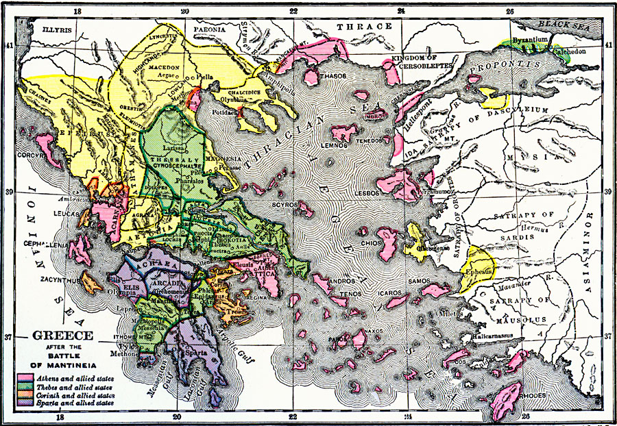
Description: A map of the Greek territories after the Battle of Mantinea (418 BC) during the Peloponnesian War. This map is color–coded to show the possessions of Athens and allied states, Thebes and allied states, Corinth and allied states, and Sparta and allied states. The map shows Greek territories from the Ionian Sea, Aegean Sea, Thracian Sea, Propontis, and along the coast of Asia Minor to Rhodes.
Place Names: Greece, Athens, �Corinth, �Sparta, �Elis, �Pylos, �Magnesia, �Aegae,�Pella,
ISO Topic Categories: boundaries,
inlandWaters,
location,
oceans
Keywords: Greece after the Battle of Mantineia, physical, �political, �battle of mantineia, kAncientGreece, physical features, major political subdivisions, boundaries,
inlandWaters,
location,
oceans, Unknown, 418 BC
Source: George Willis Botsford, Ph. D., A History of Greece (London, : The Macmillan Company, 1912) 282
Map Credit: Courtesy the private collection of Roy Winkelman |
|