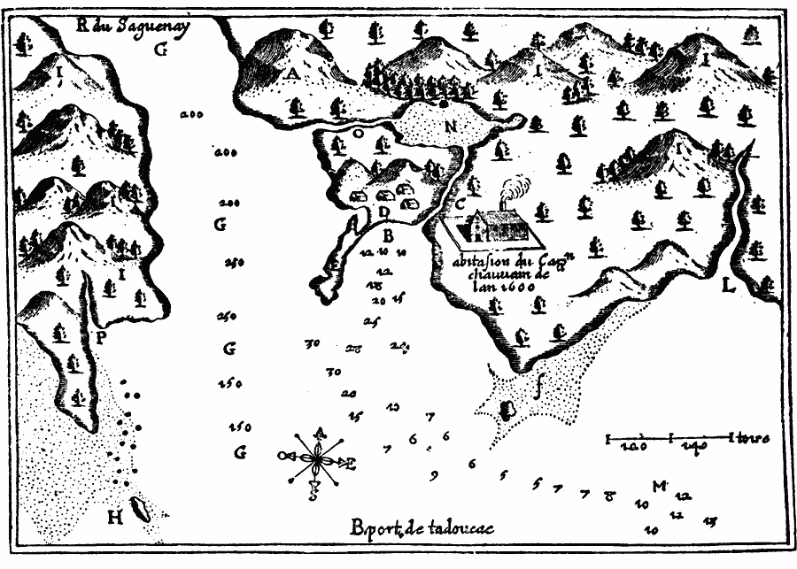
Description: A facsimile from a map by Samuel Champlain (1613) of the vicinity of Tadoussac at the confluence of the Seguenay and St. Lawrence Rivers, where he first visited on 3 June, 1608. The map is keyed to show (A) Round Mountain, (B) harbor, (C) fresh–water brook, (D) camp of natives coming to traffic, (E) peninsula, (F) Point of all Devils, (G) Seguenay River, (H) Point aux Alouettes, (I) very rough mountain covered with firs and beeches, (L) the mill Bode, (M) roadstead, (N) pond, (O) brook, and (P) grass–land.
Place Names: Canada, Port St. Loui
ISO Topic Categories: oceans,
location,
inlandWaters
Keywords: Tadoussac, borders, �physical, kEarlyMapsFacsimile, oceans,
location,
inlandWaters, Unknown, 1608
Source: Justin Winsor, Narrative and Critical History of America (vol. 4) (Boston, MA: Houghton, Mifflin, and Company, 1884) 114
Map Credit: Courtesy the private collection of Roy Winkelman |
|