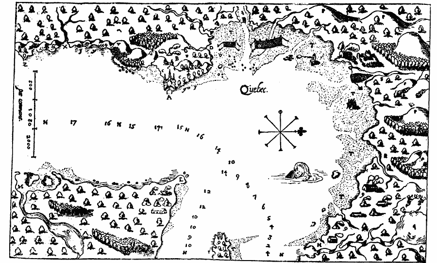
Description: A facsimile from a map by Samuel Champlain (1613) of the vicinity of Quebec on the St. Lawrence River, where on 3 July, 1608, Champlain laid the foundations of the city which still bears the name of Quebec. The map is keyed to show (A) Our habitation, now the Point, (B) cleared ground for grain, later, the Esplanade, or Grande Place, (C) gardens, (D) small brook, (E) river, where Cartier wintered, called by him St. Croix, now the St. Charles, (F) river of the marshes, (G) grass–land, (H) Montmorency Falls, twenty–five fathoms high (really forty fathoms high), (I) end of Falls of Montmorency, now Lake of the Snows, (R) Bear Brook, now La Rivière de Beauport, (S) Brook du Gendre, now Rivière des Fons, (T) meadows overflowed, (V) Mont du Gas, very high, now the bastion Roi à la Citadelle, (X) swift mill–brooks, (Y) gravelly shore, where diamonds are found, (Z) Point of Diamonds; 9 sites of Isle d'Orléans, (L) very narrow point, afterward known as Cap de Lévis, (M) Roaring River, which extends to the Etechemins, (N) St. Lawrence River, (O) lake in the Roaring River, (P) mountains and "bay which I named New Biscay," and (Q) lake of the native's cabins.
Place Names: Canada, Quebe
ISO Topic Categories: oceans,
location,
inlandWaters
Keywords: Quebec, borders, �physical, kEarlyMapsFacsimile, oceans,
location,
inlandWaters, Unknown, 1613
Source: Justin Winsor, Narrative and Critical History of America (vol. 4) (Boston, MA: Houghton, Mifflin, and Company, 1884) 115
Map Credit: Courtesy the private collection of Roy Winkelman |
|