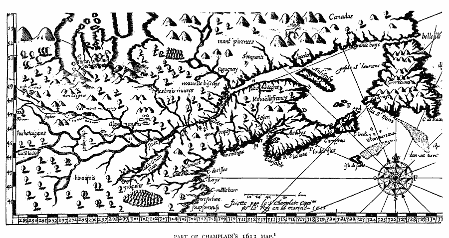
Description: A facsimile of the eastern part of a map by Samuel Champlain (1613) showing the Gulf of St. Lawrence, Terre Neuveu (Newfoundland), Cape Breton, Acadye (Acadia), Antiscoty (Anticosti Island), and the St. Lawrence River.
Place Names: Canada,
ISO Topic Categories: oceans,
location,
inlandWaters
Keywords: Part of Champlain's Map, borders, �physical, kEarlyMapsFacsimile, physical features, oceans,
location,
inlandWaters, Unknown, 1613
Source: Justin Winsor, Narrative and Critical History of America (vol. 4) (Boston, MA: Houghton, Mifflin, and Company, 1884) 382
Map Credit: Courtesy the private collection of Roy Winkelman |
|