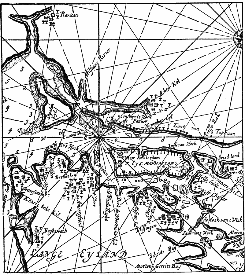
Description: A facsimile of a portion of an early Dutch map (1661) detailing Eyl Manhattans (Manhattan Island) and vicinity. The map is oriented with north to the right. The map shows the fortified settlement of New Amsterdam, the western part of Lange Eyland (Long Island) with the settlements of Breukelen (Brooklyn) and Gravesand (Gravesend), Staaten Eyland (Staten Island), and the settlement of Raritan, New Jersey.
Place Names: Early America 1400-1800, New York, �Discovery, �Colonial America, �New Jersey, �Lange Eyland, �New England, �New Amsterdam, �Breukelen, �Brooklyn, �Dutch, �New Netherland, �Staaten Eylandt, �Staten Islan
ISO Topic Categories: oceans,
location,
inlandWaters
Keywords: New York and vicinity, borders, �physical, kEarlyMapsFacsimile, physical features, oceans,
location,
inlandWaters, Unknown, 1666
Source: Justin Winsor, Narrative and Critical History of America (vol. 4) (Boston, MA: Houghton, Mifflin, and Company, 1884) 440
Map Credit: Courtesy the private collection of Roy Winkelman |
|