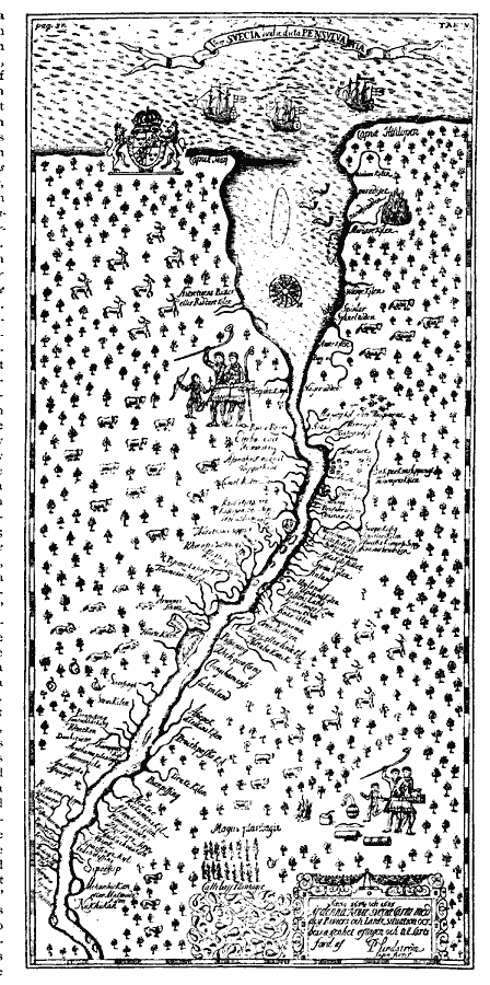
Description: A facsimile of an early map by Peter Lindström (1654–1655) showing the Delaware Bay and the territories of New Sweden and Pennsylvania. This map is oriented with north to the left, and shows Cape May and Cape Henlopen on the Atlantic, Fort Casimir (Trefaldighets), Fort Christina (Wilmington), Upland, tributaries, and the Native lands along the Delaware River.
Place Names: Early America 1400-1800, Pennsylvania, �Colonial America, �Discovery, �New Sweden, �New Netherland, �Dutch, �Swede
ISO Topic Categories: oceans,
location,
inlandWaters
Keywords: Lindstrom's Map of New Sweden and Pennsylvania, borders, �physical, kNativeAmerican, physical features, oceans,
location,
inlandWaters, Unknown, 1654–1655
Source: Justin Winsor, Narrative and Critical History of America (vol. 4) (Boston, MA: Houghton, Mifflin, and Company, 1884) 481
Map Credit: Courtesy the private collection of Roy Winkelman |
|