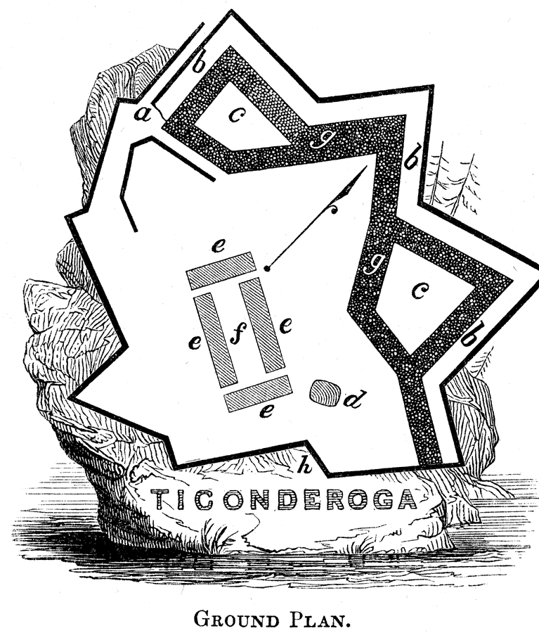
Description: Ground plans for the fortress at Ticonderoga, first built by the French as Fort Carillon between 1775 and 1778, and abandoned by the British after the failed Saratoga Campaign in 1781. The plan is keyed to show: (a) entrance and wicket gate; (b) counterscarp; (c) bastions; (d) underground room and ovens; (e) barracks and officers' quarters; (f) court or parade–ground; (g) trench or covert–way; and (h) covert–way. — Pictorial Field-Book of the Revolution Vol. I, 1851
Place Names: Early America 1400-1800, Ticonderoga, ��American Revolutio
ISO Topic Categories: structure,
intelligenceMilitary
Keywords: Fort Ticonderoga, historical, American Revolution, structure,
intelligenceMilitary, Unknown, 1755–1781
Source: Benson J. Lossing, Pictorial Field-Book of the Revolution Vol. I (New York, NY: Harper and Brothers, 1851) 118
Map Credit: Courtesy the private collection of Roy Winkelman |
|