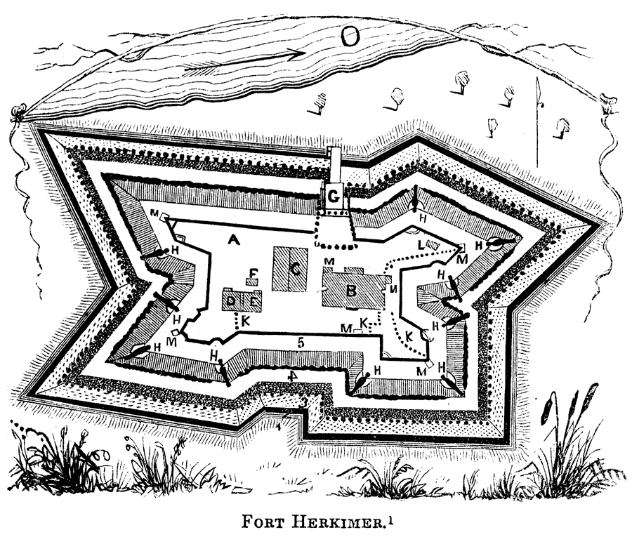
Description: A plan of Fort Herkimer on the Mohawk River, originally built during the French and Indian War, and rebuilt during the American Revolutionary War (1776, renamed Fort Dayton). The fort was destroyed during the building of the Erie Canal (1832). Explanation of diagram: (A) the parade; (B) dwelling–house; (C) barracks; (D) guard–room; (E) officers' kitchen; (F) the well; (G) draw–bridge; (H and C) ten swivel guns; (K) stockades; (L) the oven; (M and C) sentry boxes; (N) smith's shop; (O) the Mohawk River; (1) terrace; (2) trench; (3) palisades; (4) parapet; and (5) banqueting.
Place Names: Early America 1400-1800, Fort Herkimer, ��American Revolutio
ISO Topic Categories: structure,
inlandWaters,
location,
intelligenceMilitary
Keywords: Fort Herkimer, physical, �historical, physical features, American Revolution, structure,
inlandWaters,
location,
intelligenceMilitary, Unknown, 1776–1832
Source: Benson J. Lossing, Pictorial Field-Book of the Revolution Vol. I (New York, NY: Harper and Brothers, 1851) 255
Map Credit: Courtesy the private collection of Roy Winkelman |
|