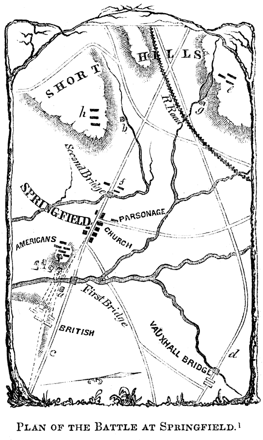
Description: A map of the vicinity of Springfield, New Jersey, showing the battle site during the American Revolutionary War (June 23, 1780). "The stream with branches, and running in a southerly direction, is the Rahway River; (a) is the house of Mrs. Mathews, near which the enemy formed for battle; (b) the site of Byran's Tavern, at the foot of the first range of hills; (c) the Springfield and Elizabethtown turnpike; (d) the Vauxhall Road; (e) the first position of the brigades of Stark and Maxwell, near the mill, and north of the rail–road; (f) Shrieve's regiment at the second bridge; (g) the mill; (h) post of the Americans, on the hills in the rear of Byram' Tavern." — Lossing, 1851, p.322.
Place Names: Early America 1400-1800, Shore Hills, �Springfield, �Rahway River, ���American Revolutio
ISO Topic Categories: inlandWaters,
location
Keywords: Plan of the Battle at Springfield, physical, �historical, kAmericanRevolution, kBattle, physical features, American Revolution, inlandWaters,
location, Unknown, 1780
Source: Benson J. Lossing, Pictorial Field-Book of the Revolution Vol. I (New York, NY: Harper and Brothers, 1851) 322
Map Credit: Courtesy the private collection of Roy Winkelman |
|