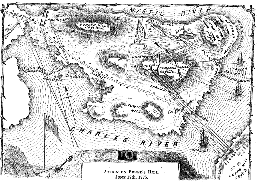
Description: A detail map of the Charlestown peninsula in Boston Harbor, showing the American and British positions at the Battle of Bunker Hill (actually Breed's Hill), June 17, 1775. The map shows the breastworks and redoubt built by the Americans, and shows the artillery positions of the British on Copp's Hill, Morton's Hill, and naval positions in the Charles and Mystic rivers, with ranges given.
Place Names: Early America 1400-1800, Mystic River, �Morton's Point, �Breed's Hill, �Copps Hill, �Town Hill, �Charles River, �Bunker Hill, ��American Revolutio
ISO Topic Categories: inlandWaters,
location,
structure
Keywords: Action on Breed's Hill, physical, �historical, kAmericanRevolution, kBattle, physical features, American Revolution, inlandWaters,
location,
structure, Unknown, 1775
Source: Benson J. Lossing, Pictorial Field-Book of the Revolution Vol. I (New York, NY: Harper and Brothers, 1851) 543
Map Credit: Courtesy the private collection of Roy Winkelman |
|