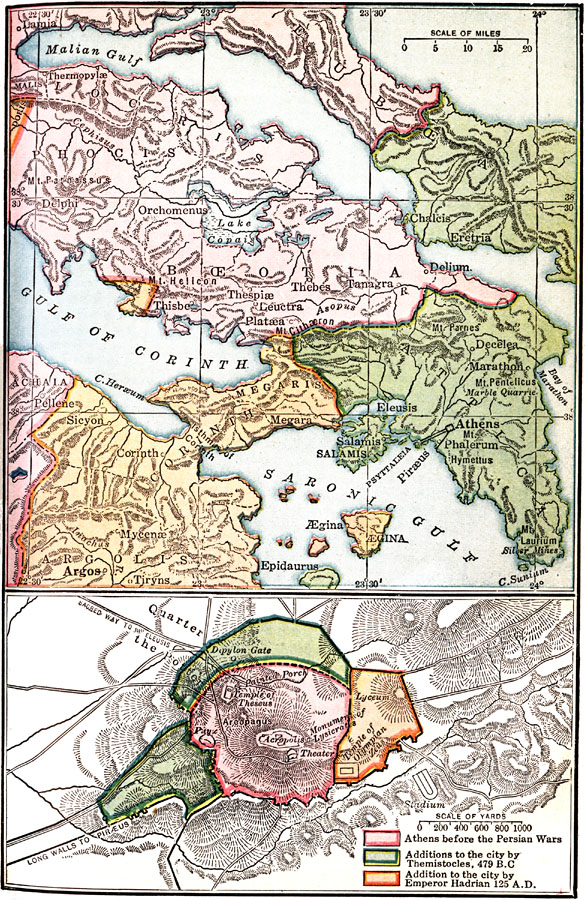
Description: Maps of Central Greece and Athens. Bottom map of Athens shows expansion of city from the Persian Wars to AD 125 .
Place Names: Greece, Argolis, �Attica, �Boeotia, �Corinth, �Euboea, �Greec
ISO Topic Categories: oceans,
location,
inlandWaters
Keywords: Central Greece and Athens, borders, �physical, oceans,
location,
inlandWaters, Unknown, 431 BC to AD 125
Source: James Henry Breasted, Ph.D., LL.D., Ancient Times - A History of the Early World (Boston, MA: Ginn and Company, 1916)
Map Credit: Courtesy the private collection of Roy Winkelman |
|