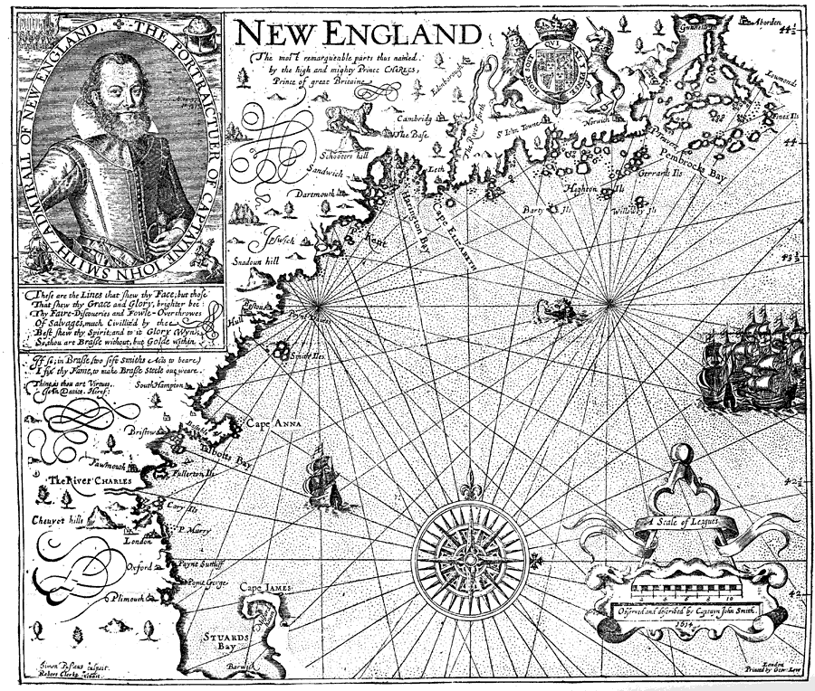
Description: A facsimile of an early map of New England as observed by Captain John Smith in 1616. The map covers the coastline from Cape James (Cape Cod) and Stuards Bay (Cape Cod Bay) north to Pembrocks Bay, and includes the inscription "The most remarqueable parts thus named by the high and mighty Prince Charles, Prince of great Britaine."e; As noted in the text: "Smith's map did not originally contain a single English name, but the young Prince Charles, to whom it was submitted in accordance with Smith's request, changed about thirty ‘barbarous’ Indian names for others, in order that ‘posterity’ might be able to say that that royal personage was their ‘godfather.’ A number of Scotch names were selected, among others, by the grandson of the Queen of Scots." — Winsor, 1884, p. 198.
Place Names: Early America 1400-1800, River Charles, �Oxford, �Plimouth, �Cape James, �Cape Anna, �Pembrocks Bay, �Norwick, �Cambridg, �Edenborough, �South Hampton, �New England,�Discovery, �Colonial Americ
ISO Topic Categories: inlandWaters,
location,
oceans
Keywords: Smith's Map of New England, physical, kEarlyMapsFacsimile, physical features, inlandWaters,
location,
oceans, Unknown, 1616
Source: Justin Winsor, Narrative and Critical History of America Vol. III (Boston, MA: Houghton, Mifflin and Company, 1884)
Map Credit: Courtesy the private collection of Roy Winkelman |
|