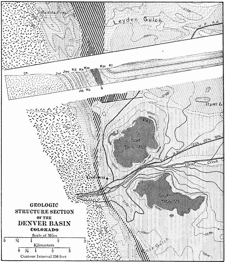
Description: A geologic map of a section of the Colorado Front Range near Denver and Golden showing the structure and topography of the common border between the Great Plains and Southern Rockies. The map is keyed to show rock types, formations, and fault lines of the lava–capped mesas near Golden, North Table, and South Table mountains.
Place Names: Colorado, Golde
ISO Topic Categories: geoscientificInformation,
inlandWaters,
location
Keywords: Denver Basin, physical, �transportation, kGeology, physical features,
geological, railroads, geoscientificInformation,
inlandWaters,
location, Unknown, 1911
Source: Isaiah Bowman, Ph. D, Forest Physiography (New York, NY: John Wiley and Sons, 1911) 364
Map Credit: Courtesy the private collection of Roy Winkelman |
|