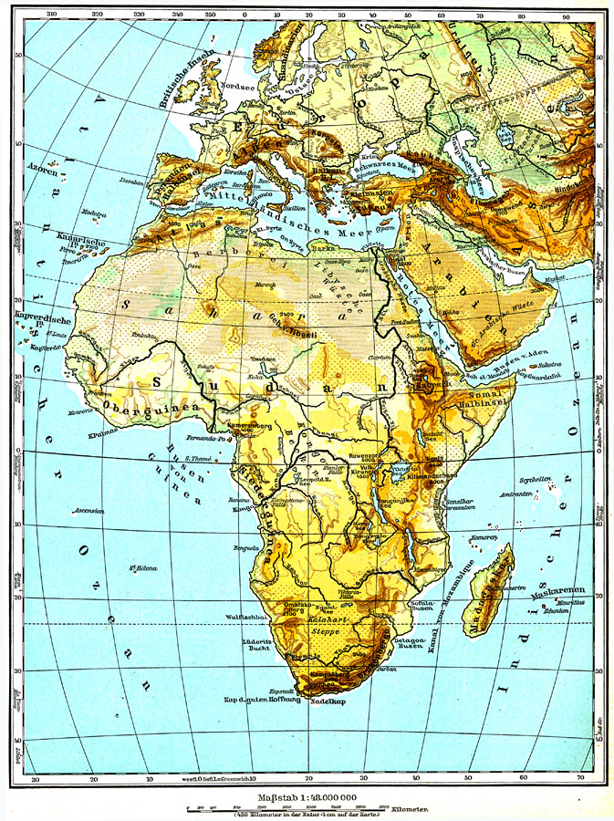
Description: Physical map of Africa showing major landforms and waterways, including the Atlas Mountains, Mount Kilimanjaro, the Saharan, Libyan, Arabian, and Kalahari Deserts, The Upper and Lower Guinea Coasts, the Congo Basin, Lake Victoria, and the Nile, Niger, Congo, Ubangi, Sambesi, and Limpopo Rivers.
Place Names: A Complete Map of Africa, Sahara, �Nile River, �Congo River, �Cape of Good Hope, �Sudan, �Atlas Mountains, �Lake Victoria, �Red Sea, �Drakenberge, �Madagasca
ISO Topic Categories: geoscientificInformation,
oceans,
elevation
Keywords: Africa - Physical, physical, �physical features, geoscientificInformation,
oceans,
elevation, Unknown, 1915
Source: C. Diercke, Lange-Diercke Volksschulatlas (Berlin, : George Westermann, 1915) 14
Map Credit: Courtesy the private collection of Roy Winkelman |
|