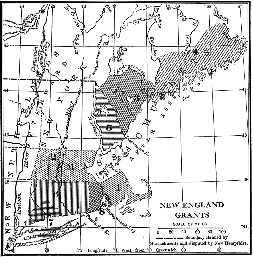
Description: A map of the Massachusetts Bay Colony and New England Confederation (1643–1684) showing the grants of the area, and is keyed to show: (1) the Plymouth Colony (1620), (2) Massachusetts, (3) Massachusetts Bay, (4) Maine, (5) New Hampshire, (6) Connecticut, (7) New Haven, and (8) Rhode Island.
Place Names: Early America 1400-1800, Connecticut, �Maine, �Massachusetts, �New Hampshire, �New York, �Rhode Island, �New England, �Colonial Americ
ISO Topic Categories: location,
inlandWaters,
oceans,
boundaries
Keywords: New England Grants, historical, �location, �physical, �political, physical features, major political subdivisions, historical event, location,
inlandWaters,
oceans,
boundaries, Unknown, 1643–1684
Source: Nathaniel Wright Stephenson, An American History (Boston, MA: Ginn and Company, 1913) 68
Map Credit: Courtesy the private collection of Roy Winkelman |
|
