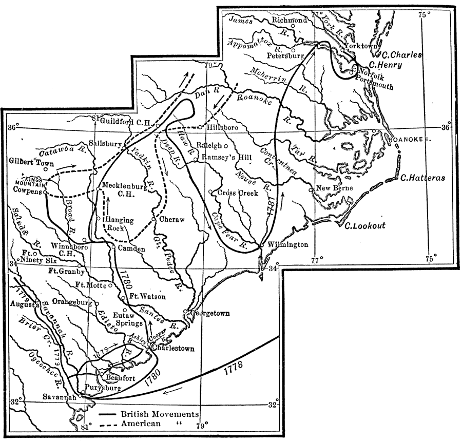
Description: A map of the southern campaigns (1780–1781) during the American Revolutionary War, keyed to show the movements by both American and British forces. The map shows major cities, towns, forts, and significant battle sites of the war.
Place Names: Early America 1400-1800, Augusta, �Charleston, �Georgia, �Guilford, �Norfolk, �North Carolina, �Portsmouth, �Savannah, �South Carolina, �Wilmington, �American Revolutio
ISO Topic Categories: location,
inlandWaters,
oceans
Keywords: The War in the South, historical, �location, �physical, kAmericanRevolution, physical features, historical event,
American Revolution, location,
inlandWaters,
oceans, Unknown, 1780–1781
Source: Nathaniel Wright Stephenson, An American History (Boston, MA: Ginn and Company, 1913) 204
Map Credit: Courtesy the private collection of Roy Winkelman |
|